 Welcome to ARTC-201 Computer Graphics 1
Fall Semester 2023!
https://irenebrination.typepad.com/files/calvino_italo_invisible_cities.pdf
***Invisible Cities PDF above
Weeks #1 & #2 – Class Introductions, Resources & Assignment #1 –>
This is our official class website!
It will grow as the semester goes on, and it will remain a resource and repository of value and inspiration for years to come! We will ALL be contributing to this website. Be sure to check out how our website navigates from the menu above.
First and Foremost, Subscribe to this Blog – look in the right hand side bar or at the bottom of the page for the opt-in – (bottom of the page if you are on a mobile device) Subscribing will allow each published post to arrive as an e-mail each week.
*The Google drive links are placed on our class Canvas page in case you need them as a reminder.
The Course Syllabus – https://artc-201.com/syllabus/
The Class Resources page – has a growing amount of useful information and inspiration that will fuel your projects with references and resources – this page will grow over the semester –> https://artc-201.com/course-resources/
The Assignments / Projects page – is located here and will grow one project / assignment at a time –> https://artc-201.com/assignments/
During weeks #1 &2 we will discuss our first project / assignment, talk about research / process expectations and go over a few demonstrations using Adobe Photoshop. My class demonstrations and tutorials from our class sessions will be recorded (just the software tutorials) and will soon be posted below.
Each week (or biweekly) there will be a new blog post published to this website on Mondays. We will navigate the class agenda from these posts.

Assignment #1
Invisible Cities – by Italo Calvino – will play a big role this semester.
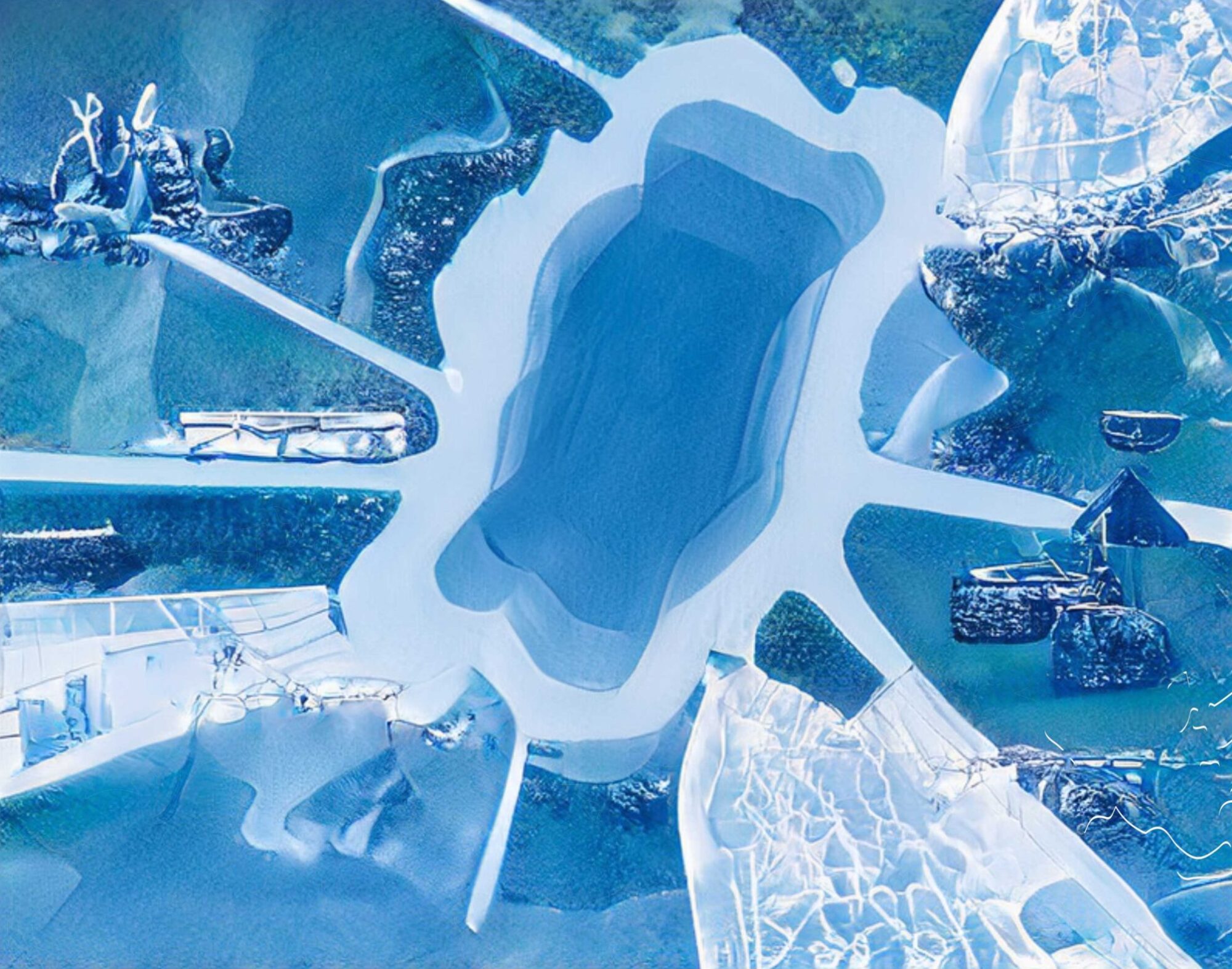
P1 – Invisible Cities – Metaphysical Guide Semester Project
Narrative / Travelogue / Way-finding / Map + Storyboard / Art Direction – Collage + Composite Imaging – Application of Layers
Deeper Research – Surrealism (Max Ernst, Yves Tanguy, Joseph Cornell, Roberto Matta)
Step 1: Read / Research “Invisible Cities” by Italo Calvino. Select one city description as your semester long project source.
(I found this free PDF of the Invisible Cities book here:

Step 2: Begin a close reading of the text to identify and develop a semester long Travelogue of an imagined place. Begin to understand the Art Direction aspect of building a worldview / environment. You will imaginatively develop / design a visual iconography and language of the world you interpret and translate from your chosen Calvino text. Construct an analog and digital sketch book / scrap book / image archive to begin developing your new Invisible City world.
Step 3: Identify and formulate the imagined world that is broadly, and vaguely suggested and described in the details and clues of the Calvino city you select. Select, collect and assemble these clues to visually shape, locate and assemble as a composite visual document. Research planets, moons, satellites and begin to art direct and curate your new Invisible City and world.
Step 4: Project 1 is focused on developing the geography, landscape and terrain of the described/imagined world in the selected Calvino city text. Create a ‘Map’ or ‘Cartographic Document’ that identifies elements described as clues from the text. Cartographic Design / Documents and Maps include landscape (landforms, water elements /tributaries) or urban features, architectural building, and urban elements, street names, place names, geographic element names, writing, coordinates, geometric markers, longitude/latitude lines, orientation indicators/compasses, wind and other weather features, natural, physical, political and invisible boundaries, legends, titles, scales, inset maps, etc. Not all are necessary or appropriate for every map, but all appear frequently enough that they’re worth developing and integrating into your Mapping/Cartography strategy. Begin by organizing the page > orientation, size and grid/guidelines for composition.
Options include selecting and elements, words, letters directly from the text and apply, transform, shape or manipulate the text using required computer software and also begin to develop, find, photograph, scan, cut, paste visual, graphic, photographic elements/images from other sources to create the composite Map/Cartographic Document and develop in future cumulative related semester projects.
Digital Tools:
Layers – 2D Map Geographies, Invisible City Composite Collage
Composite multiple images together in Photoshop ( + Illustrator + InDesign + After Effects) demonstrating knowledge of layers, masks, blending modes, and adjustment layers. Use the combination of tools above, take the time to create an artwork.
Students should be prepared to present and show both their research and work in progress / process each week with a visual presentation during our class-time. This will help us develop our ideas, presentations skills and reception of creative and critical feedback
Photoshop Basic: Tutorials

https://www.youtube.com/@Photoshop – Adobe Photoshop YouTube Channel
If you have any questions please reach out via e-mail – rseslow@nyit.com